Research project / 2026

Making the
inside readable.

An indoor-navigation prototype for Berlin Hauptbahnhof: estimate where a person is, understand which level they are on, and give them a route they can follow in the real station.

Berlin HauptbahnhofBHMT · independent
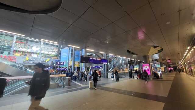
The busy concourse inside Berlin Hauptbahnhof
Berlin Hbf, level −1 · April 2026

The problem

Five levels. Long transfers. No reliable way to tell which level you are on.

A top-down route cannot explain a vertical station.

Berlin Hauptbahnhof is a complicated system of platforms, stairs, elevators, corridors, and interchanges. Moving from one train to another can take a long time because the route crosses several levels. Existing maps can show the geometry, but it is difficult to orient yourself inside the building—and especially difficult to know your vertical position.

“The line exists on the map. The challenge is matching it to the place around you.”
Overview of the indoor navigation app being developed
The prototype combines station representation, measurement, prediction, and route guidance in one workspace.

Turn station data into something a person can read.

The station’s open level data contains walls, platforms, stairs, elevators, and other objects. I convert those objects into a layered 3D representation. Semi-transparent geometry keeps the building understandable without blocking the route, so a person can see how the path moves through the station.

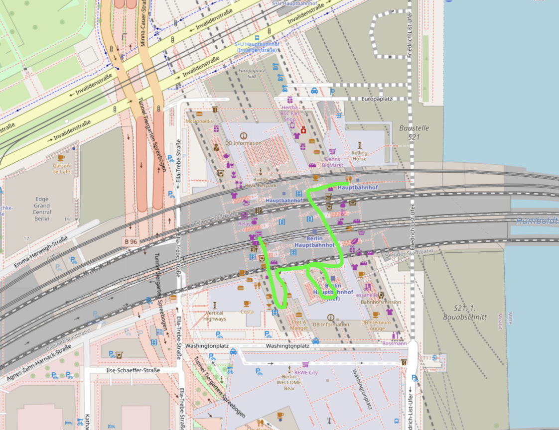
A complicated route between platforms shown from above
Top view · the transfer from platform 16 to platform 1 is hard to read vertically.
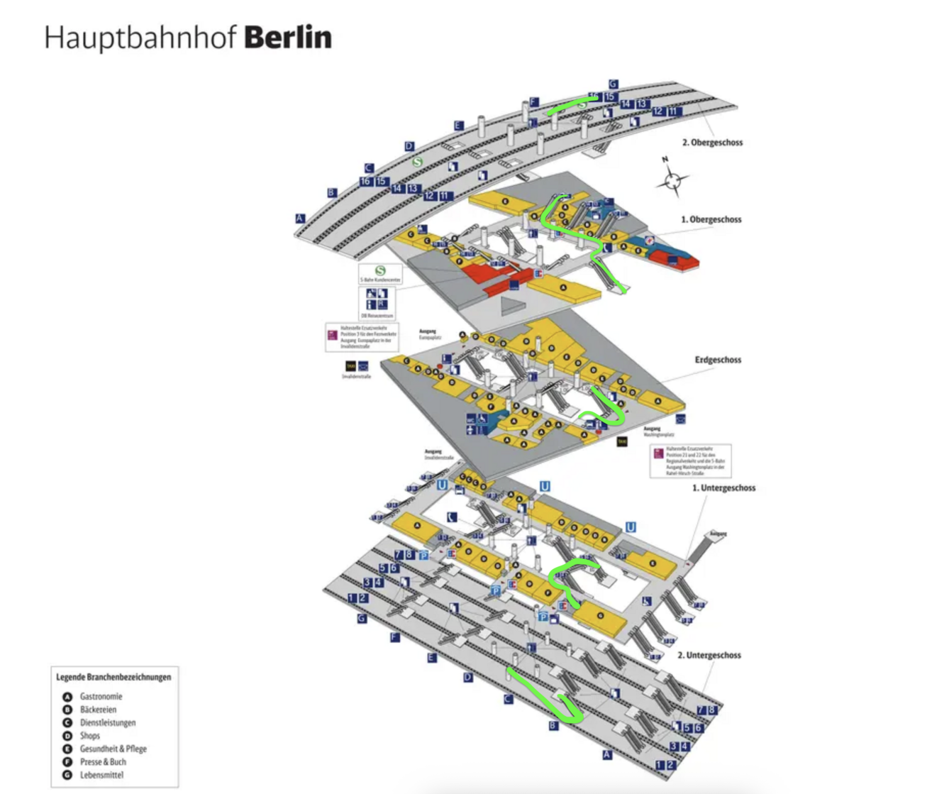
The same platform transfer shown as a 3D station breakdown
3D breakdown · the stairs and level changes become explicit.
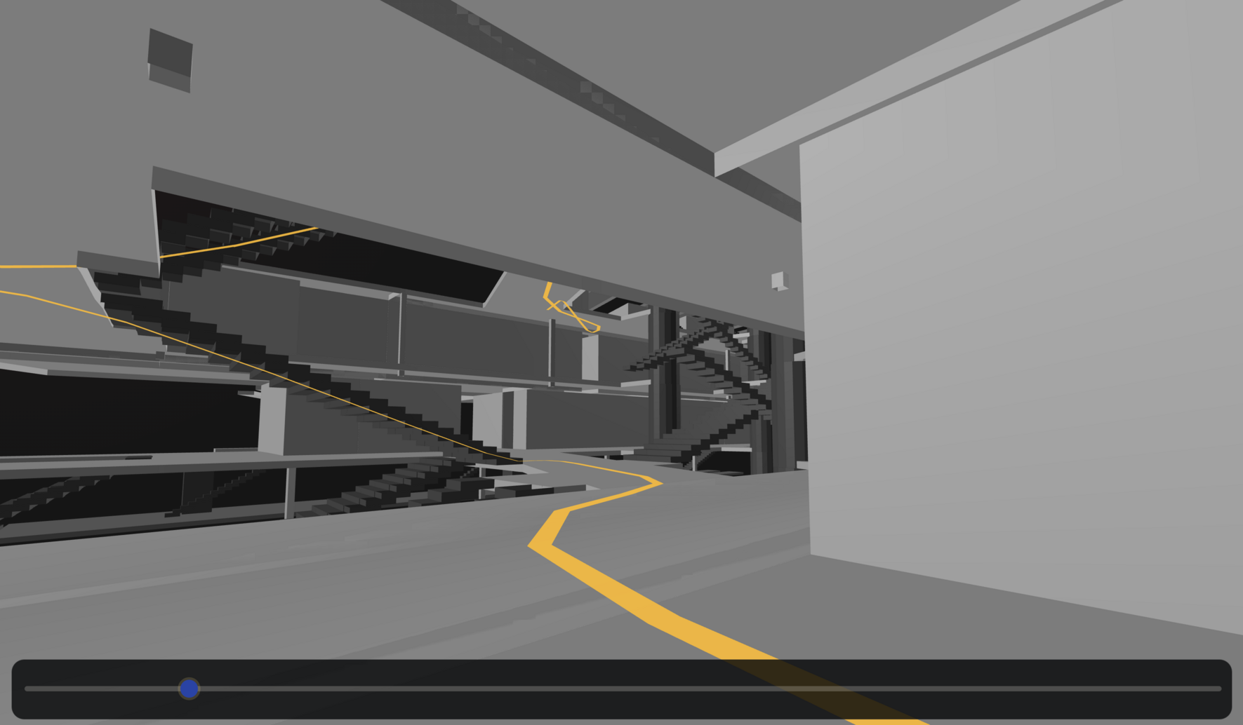
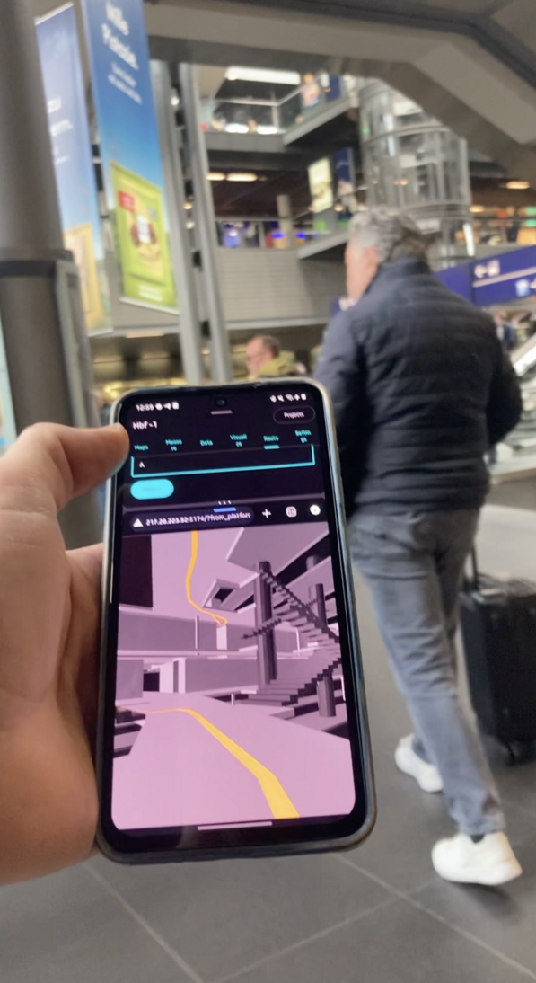
First-person view following a route through the station
First-person view · the line can be followed while looking at the station as it really appears.

Use Wi‑Fi to recover the missing vertical context.

GPS is unreliable inside the station and is particularly poor at determining which floor a person is on. I measured Wi‑Fi signal strength at known locations across five levels. Each location has a characteristic pattern of signals from nearby access points—a fingerprint.

5station levels
121measurement points
223access points
138kobservations
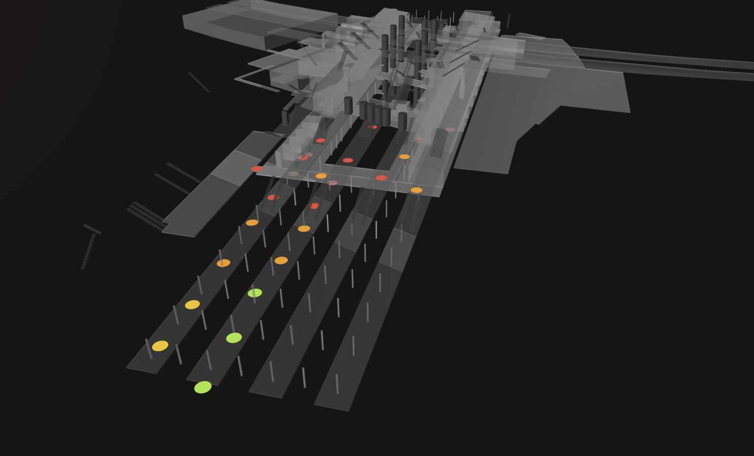
Wi-Fi signal points and heatmap across the station
Each point represents a measured signal field; together they form a fingerprint of the station.

From a live scan to the most probable place.

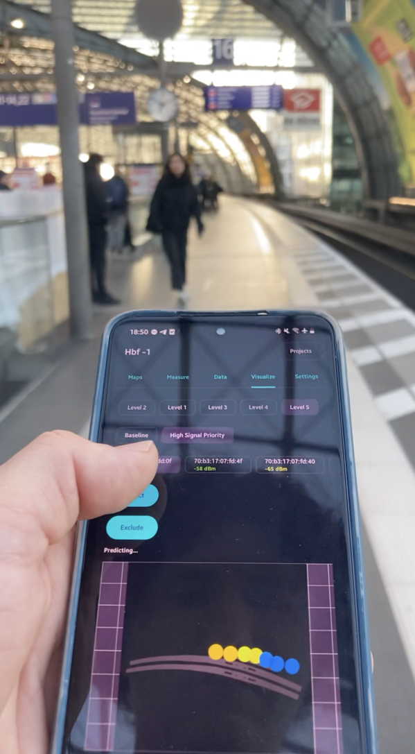
When the phone scans the surrounding networks, the system compares the observed signal strengths with the stored dataset. It selects the nearest matching measurement points and returns the most probable location and level. Repeated scans make the estimate more stable than a single observation.

Prediction screen showing the estimated indoor position
Prediction view · the nearest measured points are used to estimate location.
A phone being used for a navigation test inside the station
Offline test · comparing the phone’s view with the station in front of me.

Three services, one moving position.

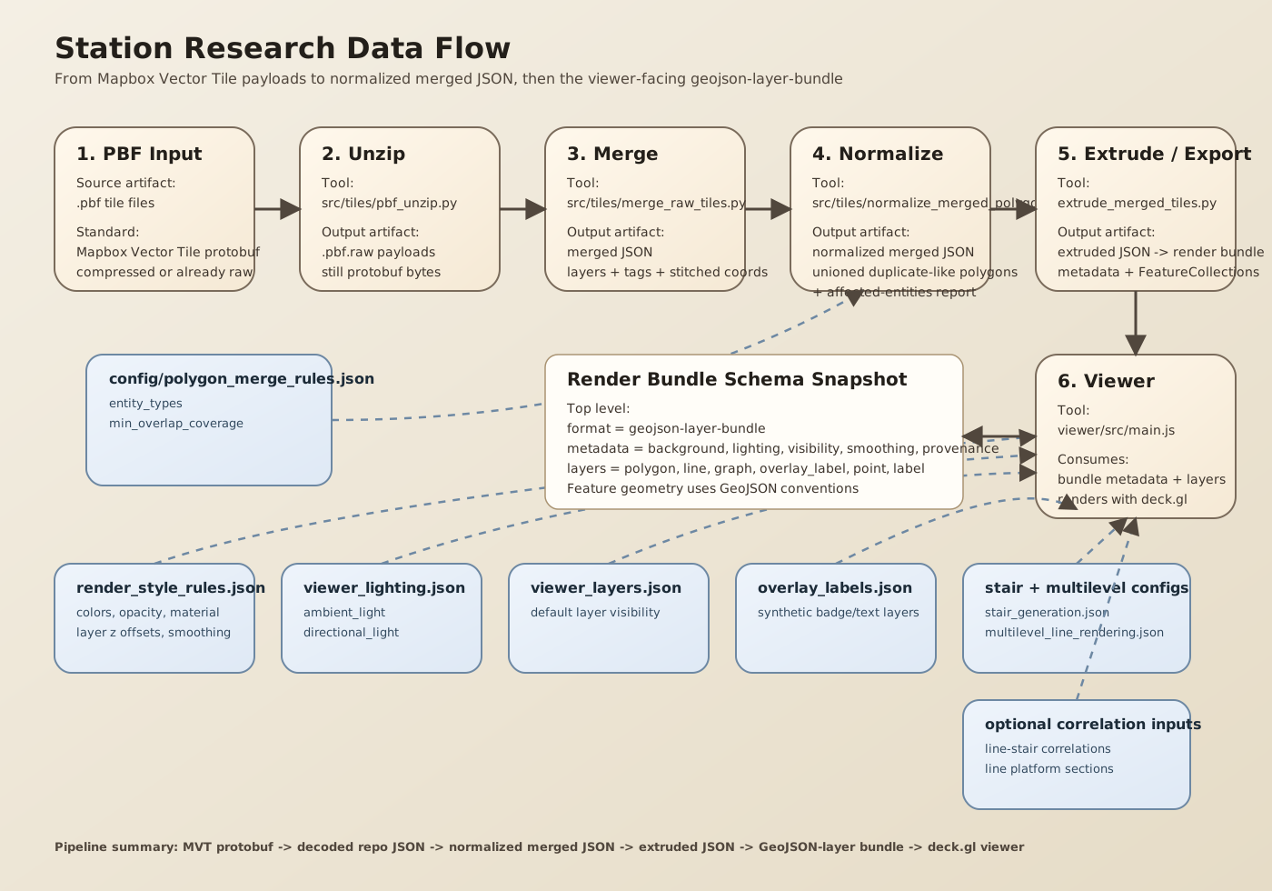
The fingerprinting service estimates the user’s position and level. The rendering service places that position on the 3D station model. The routing service draws a path between platforms. As the user walks, the prediction changes and the marker moves through the rendered station with them.

01Fingerprinting

Compare live Wi‑Fi observations with known measurement points.

02Rendering

Show the station, route, level, and current position in 3D.

03Routing

Build a walkable line between platforms and vertical connections.

Diagram of the indoor navigation data flow
Measurement becomes a location; location becomes a moving marker on the station.

A useful prediction has to agree with the world.

The prototype is tested by walking through the station with the phone. The first-person view is compared with the physical space: stairs, signs, platforms, and the direction of travel. The goal is not only to predict a coordinate, but to make the next action understandable.

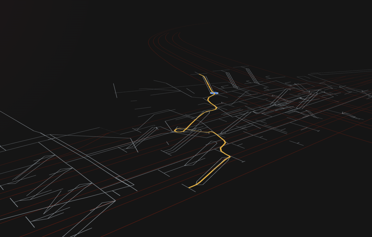
A line-only 3D view of the station route
Route view · the path without walls makes the navigation graph clear.
The source station map converted into rendered objects
Source objects · the map data becomes the station model.

Research question

Can a signal fingerprint become a useful sense of place?

This project explores whether Wi‑Fi can provide the missing vertical awareness inside a complex station, while a 3D representation turns an abstract route into something a traveller can match to the place around them.